Adding or editing points
Last updated: 2026-02-04
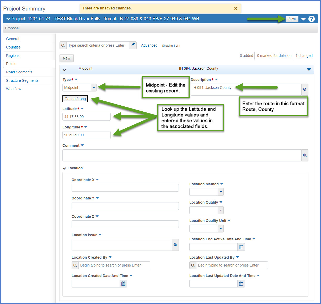
A project point is a location that can be described by a single latitude and longitude measurement and is used to locate a specific site for project work or the site for a portion of the project’s work. Complete the required fields, using the field tool tips or the Project Summary Data Fields table for guidance. Entry of this information is being done so it can be used for bid collusion analysis.
- By default, each project has ONLY ONE Midpoint record. Designers MUST edit the Midpoint record.
- NEVER create additional Midpoint records.
- Creation of Beginpoint and Endpoint records is optional.
Follow the guidance in the table below to update the required MidPoint record or adding optional Beginpoint or Endpoint records.
- Expand the Midpoint record.
- Update the required fields as noted in the table below.
- Click <Save>.
OR - Click <New> to create a BeginPoint or EndPoint record.
- Enter the required fields as noted in the table below.
- Click <Save>.
| Record Type | Field | Required | Description |
|---|---|---|---|
|
Midpoint, Beginpoint, Endpoint |
Type |
Midpoint - Required Beginpoint - Optional Endpoint - Optional |
Midpoint - Leave Midpoint as the selection for the existing record. Expand and edit the existing record. Warning:
The designer has the option to create additional records for the BeginPoint or EndPoint.
|
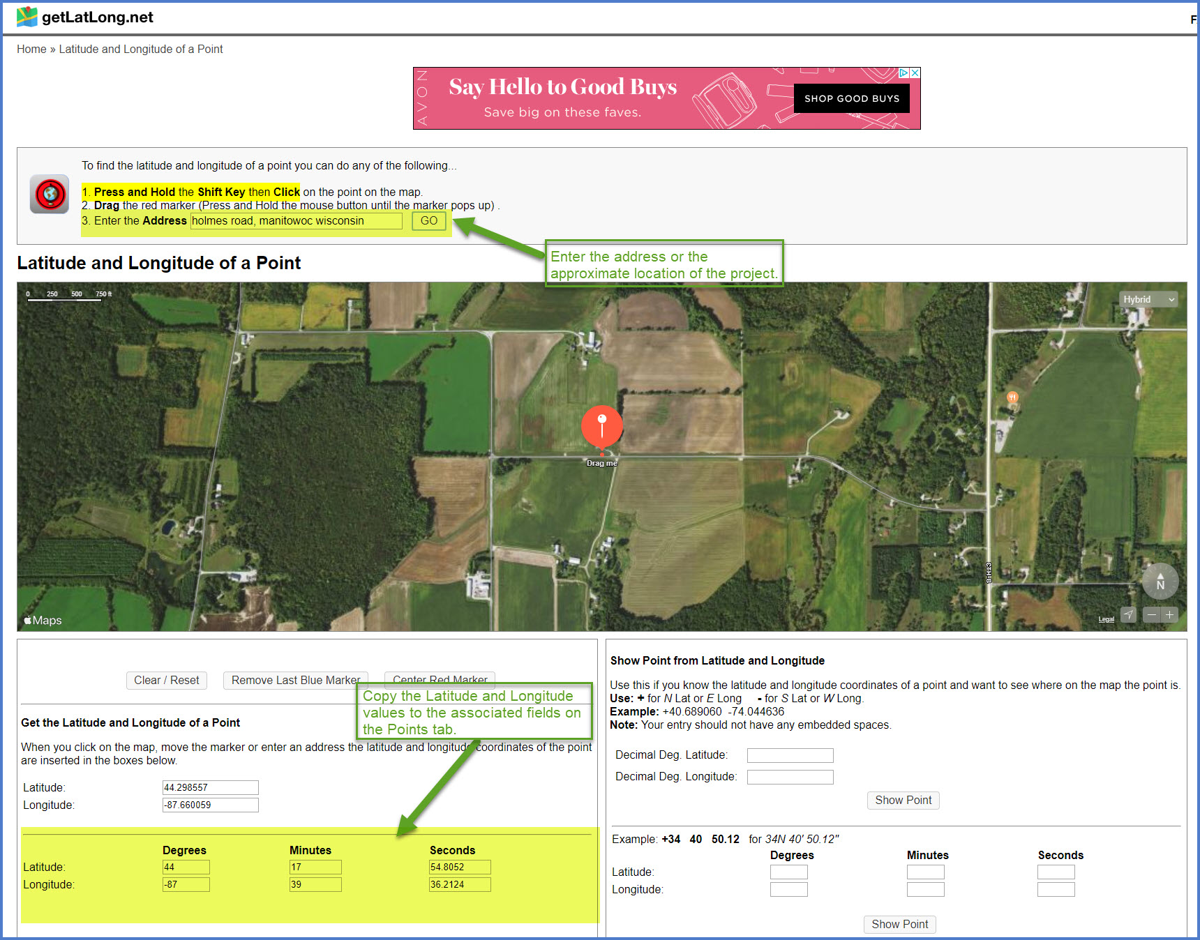
| Latitude and Longitude |
Yes |
Requirements:
|
|
| Description | Yes |
Midpoint record
Beginpoint or Endpoint records
Examples:
BUS 051, Marathon County |


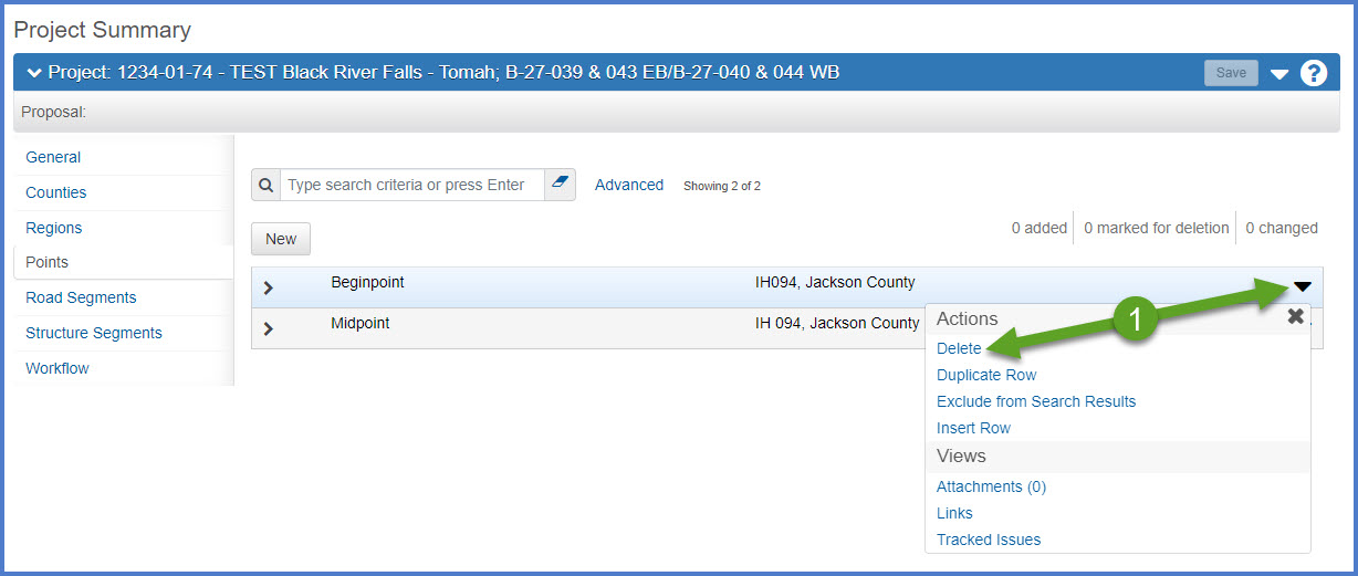
- From the Project Summary Points tab, locate the point record to delete. Select Open Row Actions Menu | Delete.

- The point record is marked for deletion and designers may “undo” the action by clicking the undo button.
- Click <Save>.

Go to Categories, the next step under Creating an estimate in Preconstruction.